Blog
Protecting biodiversity in the rail corridor
One of the many struggles when starting a new project, particularly those that spread across a vast area, is measuring the biodiversity of the area. Protecting biodiversity hotspots is an important consideration in new developments, and new technologies are lending a helping hand.
Large scale projects like the Inland Rail have an ongoing commitment to environmental sustainability. Looking to go beyond impact minimisation, Inland Rail seeks to create opportunities for habitat restoration, and where impacts to biodiversity cannot be avoided, offset such impacts. With the help of vegetation mapping, based on a field survey and analysis of aerial photographs, planning for restoration and the reestablishment of native vegetation can be conducted effectively.
Across the seas in Britain, the Network Rail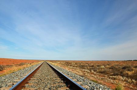 project has taken up satellite imagery as a significant tool for the execution of their sustainable vegetation management plan. In partnership with the UK Centre for Ecology and Hydrology, the Network Rail follows a detailed habitat map that covers all areas of the rail project. With this information, it is possible to predict what animals and plants may be present in the area.
New technology is increasingly important in ensuring the sustainability of the rail industry, helping with the management of habitat, and ongoing monitoring of ecological trends. Breakthroughs like habitat mapping from satellite imagery are helping to minimise the impact on the natural environment.
As work continues in the surveying industry, and technology continues its rapid evolution, there will be huge growth opportunities for the industry to better its practices and improve overall accuracy. In terms of rail projects, the ability to protect biodiversity through the use of technologies creates an opportunity for greener travel and freight.
